Saturday, 22 August 2020

Not only nature at Egypt bay (20/08)

Smugglers, literary inspiration, marsh frogs and seals in a bay of tranquility situated in the busy Thames Estuary

Lonely Egypt Bay is reached by a 3-mile walk along country footpaths from High Halstow. You rarely see other people out here, just the occasional walker or perhaps a local farmer out tending his animals. Yet barely 2 miles away on the other side of the estuary is the heavily industrialised south coast of Essex where the huge D.P. World London Gateway container terminal  & Canvey Island gas terminal are situated. Massive container ships pass barely a mile offshore & the flight paths of aircraft serving London City &  Southend airports pass overhead. Yet Egypt Bay remains an oasis of tranquility surrounded by the turmoil of the modern world. It is a world of wildfowl & waders which visit in large numbers to feed on the rich estuarine mudflats. Common seals can often be seen fishing just offshore & inland, the fleets & dykes are home to cackling marsh frogs, grass snakes, & nesting warblers & waterfowl.

Birds of prey such as marsh harrier, short-eared owl & kestrel hunt over the surrounding marshes. The area remains a stronghold of the increasingly uncommon wall brown butterfly & the rare shrill carder bumblebee.

There remains some mystery as to how this place got the rather exotic name 'Egypt Bay' but the most likely explanation is its proximity to local sites where Phoenician artefacts were discovered & the perceived similarities of the small sandy beaches of Egypt Bay to the sands of the Egyptian desert. The ancient Kingdom of Phoenicia was located where the modern country of Lebanon is situated which is almost next door to Egypt & thus, you arrive at the name, 'Egypt Bay'. The Phoenicians, who were at their zenith between 1100 & 200 BC were renowned traders, seafarers & explorers. They undoubtedly visited & traded in & around the Thames Estuary during that period.

Charles Dickens, who lived a few miles away at Gad's Hill, was known to have visited the area around Egypt Bay & is believed to have perceived this place as the location of the prison hulk which the convict, Magwitch, escaped from in Great Expectations. Cooling churchyard where he had his encounter with 'Pip' is just 2 miles away. In reality no prison hulks were ever moored in the vicinity of Egypt Bay. The nearest ones were located in the Medway Estuary on the other side of the Hoo peninsula.


Sea lavender in bloom at Egypt Bay.

The marshes just inland of Egypt Bay. Cliffe can be seen in the distance.


One of the fleets which present an attractive habitat to so much wildlife.


The strange- looking 'Shade House is situated on the Halstow marshes just to the south of Egypt Bay. It was originally a shepherds cottage & gained notoriety as a hideout of the infamous 'North Kent Gang' which was a group of smugglers who operated in this area during the 18thC. Around that period the marshes here were malarial & life expectancy of the local residents was only 30 years. Consequently, most people avoided the area & it was extremely sparsely populated. This made it a very attractive haunt for smugglers & they centred their activities in & around Egypt Bay. The windows in the Shade House all face south, supposedly so that the inhabitants would be readily alerted to any approaching excise officers ( the south being the most likely direction they would come from).

There are unsubstantiated rumours of vaulted tunnels leading from the house to Egypt Bay & other stories of how the smugglers would pay local shepherds to drive their flocks down the tracks & paths frequently used during smuggling activities so as to destroy  any evidence of their presence.


The new Salt Fleet Flats Nature Reserve lies just about 100 metres to the west of Egypt Bay. It is part of a 'habitat compensation scheme to replace habitat lost on the opposite bank of the Thames Estuary during the construction of the D.P. World London Gateway container port at Stanford-le-Hope in Essex. The new reserve comprises 59 hectares of intertidal mudflats & 6 hectares of salt marsh. It was created by breaching a 700m long section of the existing sea wall after a new one, some 2 .4 km in length, had been built inland. This was the largest breach of a sea wall anywhere in the UK. The contractors worked closely with the RSPB to create the most favourable  habitat for birds & collaborated with the Bumblebee Conservation Trust in developing a bespoke seed mix to be sown along the new sea wall to attract rare bumblebee species such as the shrill carder bee.

The area attracts large numbers of waders & wildfowl as well as a variety of other bird species such as yellow wagtail,pipits & finches which occur along the new sea wall. However, it should not be forgotten that a large area of fresh marsh , including several fleets & dykes which provided a valuable habitat for wildlife , was lost as a result of this project.


A number of these shallow pools which were created just inland of the new sea wall are attractive to small wading birds such as ringed plover, oyster catcher & green sandpiper.


The Thames foreshore just west of Salt Fleet Flats.


A Chinese container ship leaves London Gateway.

Thursday, 13 August 2020

In case you hadn't had enough already.... more Saxon Shore Way(!) from Rye to Appledore (28/7)

The Saxon Shore Way footpath from Rye to Appledore is officially 8.2 miles long. However, I walked just over 10 miles because I had to backtrack in several places, including areas both north & south of the Isle of Oxney & on the approach to Appledore village. This was mainly due to poor waymarking. I actually found one waymarker post tossed into a ditch near Cliff Marsh Farm. Overall, this is a pleasant walk in lovely countryside & offers panoramic views over Romney Marsh as you ascend the old cliff line to the Isle of Oxney. The first part of the route follows the R. Rother & then the Royal Military Canal. Unfortunately, this latter section runs very close to the rather busy Royal Military Road which although unclassified, carries overspill traffic from the busy A259 in this area.


Looking back towards Rye along the tidal R. Rother.


The view upstream. The Union Channel which drains part of Walland Marsh can be seen joining the Rother from the right.


The bright yellow flowers of fleabane grow along the riverbank here. This flower was traditionally used as an insect repellent. It is a close relative of pyrethrum which is used as an insecticide.


Also, Tansy, which is another plant with an aromatic smell that deters insects.


At Iden Lock the Saxon Shore Way leaves the banks of the R. Rother & heads north along the towpath of the Royal Military Canal. The latter runs for 28 miles between Seabrook, near Folkestone & Cliff End, near Hastings. It was constructed between 1804 & 1809 in order to form a defensive line should the French try to use Romney Marsh as a bridgehead during any invasion of Britain.


After ~1 mile the Saxon Shore Way leaves the towpath & heads N.W. across farmland towards the old cliff line of the Isle of Oxney. The border between Kent & Sussex (the Kent Ditch) also runs through here.


I found henbane growing alongside a dyke here. Although this plant has a beautiful flower it is very poisonous & was commonly used in witchcraft because of its hallucinogenic properties. There is an account of a community of monks who mistakenly ate the roots of some henbane as part of their evening meal. (They thought it was chicory). Apparently, later that evening it was reported that the monastery resembled a lunatic asylum!


The 15th C. St. Mary's church at Stone in Oxney.


The Old Schoolhouse, Stone in Oxney.


I found this strange fungus which resembled a grapefruit skin, growing on a bank beneath an oak tree in the village.


A rare form of viper's bugloss with white flowers was growing by a farm track near Luckhurst Farm, Stone.


The Reading Sewer is one of the main drainage channels near Appledore. It flows into the Royal Military Canal on the outskirts of the village.


The 14thC church of SS. Peter & Paul, Appledore. It was burnt by the French in 1380 & restored in the 19thC.

Thursday, 6 August 2020

The ancient causeway that time has forgotten (Higham/Thames, Kent, UK)

Recently, whilst trying to find a footpath across the marshes between Higham & the Thames, I came across an old causeway that has an interesting history. My interest was aroused initially by the causeway's proximity to feature on the map named 'Barrow Hill' which may have been a Bronze Age burial mound. Detailed information was difficult to find but I gradually pieced together its history.

This area has always been well populated since at least Neolithic times. There are several reasons for this. The marshes & the nearby Thames estuary provided a plentiful source of food such as wildfowl & fish. Also the area consisted of much rich  meadowland before sea levels rose & the area was partially inundated during the Middle Ages.

The river & estuary  provided easy access both inland & overseas allowing contact with peoples in other parts of Britain, continental Europe & beyond. This is proven by several significant archaeological   finds made in the vicinity.

These include pre-Roman Gallo-Belgic coins found concealed in a hollow flint not far from the causeway & a large amount of Phoenician pottery discovered in the estuary at Egypt Bay which is situated a little further downstream. ( 'Egypt Bay' gets its name from this find). Roman pottery has been found on numerous occasions, pieces often being unearthed when new graves are dug in St. Mary's churchyard and a large amount was discovered during repair work on the seawall in the 1950's. Records suggest that during their successful invasion of Britain in 43 AD it was across this causeway on Higham marshes that the Roman army pursued a significant proportion of the Ancient Briton's forces before they fled across the Thames to Essex.


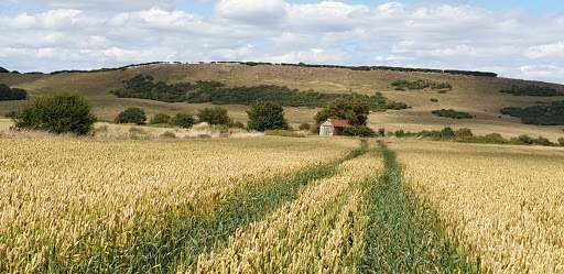
The  causeway winds its way across the marshes.


A Dyke borders the causeway for much of its way.


Barrow Hill lies ~100 metres east of the causeway. It was always assumed to have been a Bronze Age burial mound but excavations during the late 19thC. discovered little of significance & now some believe that it may be simply a mound on which a bonfire could be lit to guide the ferry over from Essex during bad weather.


Lesser water parsnip growing in the Dyke alongside the causeway.

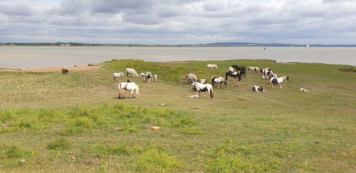
Semi-wild ponies & their foals graze by the saltmarsh where  the causeway meets the Thames. This crossing to East Tilbury in Essex is believed to have been a ford originally & the Romans extended the causeway right across the river here. However, rising sea levels during the Middle Ages made both of these impassable & a ferry was put in their place. This remained in operation until the 16thC. when the service was transferred upriver to Gravesend.

St. Mary's church lies on the edge of the marshes close to the beginning of the causeway. A church was founded here in 774 during Saxon times but the current church was rebuilt after the Norman Conquest & then remodelled & enlarged during the 14thC. when a priory of Benedictine nuns was established nearby. The priory was responsible for maintaining both the ferry & the causeway & was allowed to levy a fee for this. It closed in 1522 & nothing  of it remains except for remnants of a wall on land at a neighbouring farm. Interestingly, St. Mary's was Charles Dickens' local parish Church & his daughter, Kate, was married here. The church is now redundant & under the care of the Churches Conservation Trust.

The 15thC. door of St. Mary's church is finely carved with motifs of roses, lilies & human faces.