Thursday, 24 December 2020
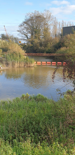
R.Medway between Tovil & E.Farleigh this morning.
Thursday, 19 November 2020
Autumn colours around the lower Medway Valley nr. Rochester (11/11)
I began this walk from the B2097, Maidstone Road, Rochester & crossed the M2 motorway & HS1 railway via bridges on Stoney Lane to descend into the Nashenden Valley. It was not difficult to imagine what a beautiful idyllic place this must have been before it became the major transport artery that it is today. Both the M2 motorway & HS1 railway run alongside each other through the valley.
A Eurostar train en route for Europe about to enter the 2mile long Boxley tunnel beneath the North Downs.
The path through Bridge Wood emerged onto the North Downs Way by the Robin Hood public house. I turned right here & followed the NDW past Wouldam Common where there are panoramic views over the Medway valley towards the North Downs, the Greensand Ridge, and the Weald.
From Wouldham Common the North Downs Way continues north past the Kent Wildlife Trust Nashenden Down nature reserve. This was established in 2009 & covers 55 hectares. It was previously arable farmland & the Wildlife Trust is managing it to promote diversity by planting hedgerows, creating ponds & using sheep for conservation grazing to encourage the growth of beneficial native wild flowers such as cowslip, wild marjoram & oxeye daisy. These in turn should attract butterflies & other beneficial insects.
Shoulder of Mutton Wood is owned by the Woodland Trust & forms part of the Nashenden Down nature reserve. It covers 2.2 hectares & has been here since at least AD1600. The predominant species is beech.
A Bronze Age burial mound dating from between 1500 & 1100 BC is located in Shoulder of Mutton Wood.
Good views of the viaducts carrying the M2 motorway & HS1 railway over the R.Medway near Rochester.
Notice near Nashenden Farm.
Just after Nashenden Farm I left the North Downs Way & took this bridleway back to Stoney Lane.
Wild clematis & wild privet growing alongside the bridleway.
Wednesday, 11 November 2020
The Saxon Shore Way, Dover to Deal (04/11)
This section of the Saxon Shore Way is 10.2 miles long. It is very picturesque with magnificent coastal scenery & has much of interest along the way. The first half of the walk is over the cliffs between Dover & Kingsdown & is fairly hilly & rugged but after that the terrain is flat & offers easy walking along a very pleasant segregated foot/cycle path all of the way to Deal. The route is easy to navigate as it simply follows the coastline northwards & waymarking is very good virtually the whole way. The only area that may present difficulties is where the path threads its way through the settlement at St. Margaret-at-Cliffe.
Dover Castle, ‘the Lock and Key of England’, dates from the twelfth century & is situated on a hill dominating the town & surrounding countryside. Owing to its strategic location at the narrowest crossing point to continental Europe, Dover has a long & interesting history. As ‘Portus Dubris’ it was an important Roman settlement & one of the Saxon Shore forts was built here to help protect the Kentish coast from Saxon & Frankish raiders. Traces of neither this nor the Roman harbour exist today. The only surviving structure from this period is the shell of a Roman pharos lighthouse. During the Middle Ages Dover was regarded as head of the Cinque Ports and the town & surrounding area are dotted with the remains of defensive fortifications built during previous eras.
Dover Harbour.
Dover is one of the busiest passenger ferry terminals in the
world, the busiest cruise liner terminal in the UK & a major port for
freight, especially fruit.
Impressive cliff scenery near Fan Bay.
These are the famous ‘White cliffs of Dover’.
Cross Channel ferries
The French coast is only 21 miles from Dover & is
clearly visible. The narrowest point is a little further north at St.
Margaret-at-Cliffe where it is only 18 miles to France.
South Foreland Lighthouse.
A Victorian lighthouse built in 1843 to warn shipping of the Goodwin Sands which lie just offshore. It was the first lighthouse to use an electric light & the location of the first international wireless transmission by Marconi in 1895. It ceased operations as a lighthouse in 1988 & is now owned by the National Trust.
St. Margaret-at-Cliffe
A large picturesque village set among the cliffs at South
Foreland. At 18miles it is the closest point to France.
St. Margaret-at-Cliffe
Monument to the Dover Patrol, Leathercoat Point, St.
Margaret-at-Cliffe.
Designed by Sir Aston Webb & erected in 1921 to
commemorate the vital role played by the elite fleet of the Royal Navy known as
the ‘Dover Patrol’ in protecting allied shipping in the English Channel during
World War I.
Bockhill. A beautiful area of farmland on the cliff-top just north of St Margaret-at-Cliffe & now owned by the National Trust. It is a renowned location for observing the coastal migration of birds with over 240 different species having been recorded in the immediate vicinity. Many interesting & unusual species of moths, butterflies, dragonflies & other insects have also been found here.
The view looking north from Bockhill towards Kingsdown, Walmer & Deal.
Walmer Castle at dusk.
The official seat of the Lord Warden of the Cinque Ports. It
is one of the 3 castles erected by Henry VIII in 1539 to protect the strategic
naval anchorage known as the ‘Downs’ which lies just offshore here.
Deal Castle: another of the castles built by Henry VIII to protect the 'Downs'.
Saturday, 7 November 2020
Wednesday, 28 October 2020
Saxon Shore Way, Upstreet to Herne Bay (25/10)
The path heads north across a ploughed field at the start of
the walk near Upstreet.
This is a relatively easy 9 mile walk from Upstreet to Herne Bay over fairly level ground. It passes through mainly arable farmland with a short stretch through orchards at Boyden Gate & a final leg along the coast between Reculver & Herne Bay. The route is easy to navigate as you simply head due north from Upstreet to Reculver & then turn west & follow the coastline to Herne Bay. Way marking is good the whole way. The only area where things can be a little confusing is among the orchards at Boyden Gate but if you just follow the compass north you should have no problem. There are regular bus services between Canterbury & Upstreet at the beginning of the walk & Herne Bay & Canterbury at the end. The weather on the day I did this walk was very murky with persistent heavy rain & this accounts for the poor quality of the photographs. I will definitely do this walk again during better weather, probably next spring.
Shortly after the start of the walk the Sarre Penn stream is
crossed via a small foot bridge.
This is a 13km tributary of the R. Stour which rises in
Dunkirk, north of Canterbury & then
joins the R. Wantsum at Sarre before flowing into the Stour near Plucks Gutter.
The lower reaches near Sarre are known locally as the Fishbourne Stream.
A misty view of Chislet Village in the rain. The SSW passes
just to the east of the village through the hamlet of Chitty.
Area-wise Chislet is one of the largest parishes in north east Kent. It has several notable features including its chunky looking church of St. Mary the Virgin which was built by the Normans during the 12th C. It was also home to the Chislet Colliery coal mine located ~2miles south west of the village at Hersden . This was in operation between 1918 & 1969 & produced a type of coal sought after by the steel industry. At its height it employed some 1550 miners. Interestingly the mining operations led to the creation of the nearby Stodmarsh National Nature Reserve when underground workings caused subsidence over a large area of the R. Stour valley. The subsequent formation of shallow lagoons & what was to become the largest reed-bed in S.E.England created a valuable natural habitat for many rare species of birds, insects & aquatic plants. Stodmarsh was given SSSI status in 1951 & declared a National Nature Reserve in 1968.
The SSW passes the grade ll listed 18thC Invicta Cottage in
the hamlet of Chitty, near Chislet village.
After leaving the apple orchards at Boyden Gate the SSW
follows a quiet lane before crossing a bridge over the busy Thanet Way motorway
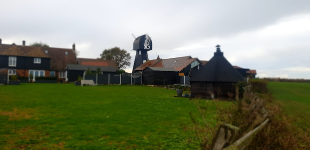
to pass close-by Chislet Windmill. A smock mill was built here in 1744 &
remained working until 1916 when it was badly damaged in a gale. During World
War II, Barnes Wallis lived in the mill house & observed the tests of his
famous ‘bouncing bomb’ at Reculver from
the top of the mill. Unfortunately it was destroyed by a fire in 2005 but a
replica mill was built in its place in 2011.
Texel sheep grazing next to the path near Reculver. This is
a popular breed with farmers because of the demand for its high quality very
lean meat.
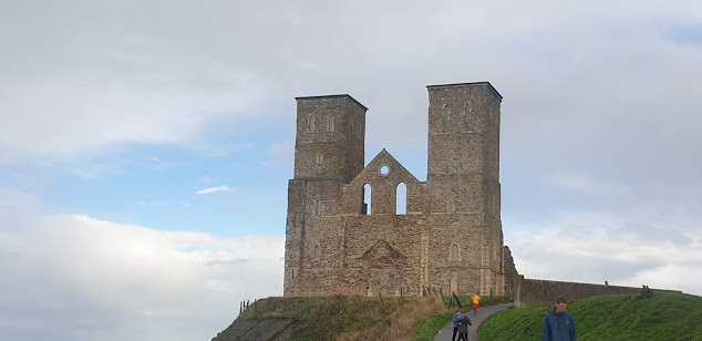
The Towers, Reculver.
Soon after
the Roman invasion of Britain in AD43 a settlement based on a harbour was
established here at the northern end of the 3 mile-wide Wantsum sea channel
which, in those days, separated the Isle of Thanet from the Kentish
mainland. Richborough ( Roman Rutupiae or Portus Ritupis), the principle port
of the new Roman Britannia Province & built on the site where the Romans
first came ashore, was located at the southern end of this channel. The Roman
settlement at Reculver grew in size & during the early 3rd
century one of the earliest Saxon Shore Forts ( Regulbium) was built here to
protect the area against Saxon & Frankish raiders. By the fifth century the
fort had been abandoned & an Anglo Saxon monastery was founded on the site
in 669. The church of St. Mary was built here as part of the monastery complex
and during the tenth century this became the parish church of Reculver after
the monastery ceased to exist. The famous twin towers were added as part of a
remodelling of the church during the twelfth century. Coastal erosion became an
increasing problem during subsequent years & in 1805 the medieval church
was partly demolished & the stone used in the construction of a new church
on higher ground at nearby Hillborough. The twin towers had become an important
landmark & navigational aide for mariners so were left in place &
subsequently bought, repaired & reinforced by Trinity House in 1809.
Looking back along the SSW towards Reculver from Herne Bay.
From Reculver the SSW follows a well defined path along the
coastline to Herne Bay which is situated some 2 miles to the east. Herne Bay (pop. 40,000), a quiet & pleasant town renowned for its sunny climate is
popular with retirees. It developed rapidly as a seaside resort during the
nineteenth & early twentieth centuries after the arrival of the railway during the
1830’s made it easily accessible from London. The town’s mile long parade &
¾ mile long iron pier were great attractions, especially the latter which
allowed paddle steamers carrying visitors
from London & the Medway Towns to dock here. The advent of foreign
holidays during the latter half of the twentieth century has led to a marked
decline but it remains an attractive seaside town to visit. Unfortunately the
pier remains in a poor state of repair after severe damage incurred during
storms & the pier head remains isolated out at sea. There have been several
plans to repair & reinstate the structure but so far nothing has
materialised.
Thursday, 22 October 2020
Saxon Shore Way, Aldington to Ham Street - including Orlestone (19/10)
Sheep grazing along the old cliff line near Aldington.
A 6mile walk along the Saxon Shore Way path from Aldington
to Ham Street with a short diversionary trip to the hamlet of Orlestone.
Cherry Orchard Cottage, Bonnington. A lovely old timber
framed cottage, c.1691.
After descending the old cliff line at Aldington the SSW passes through the hamlet of Bonnington which is centered on Cherry Orchard Lane. At the end of this lane it heads S. down Rocky Bourne Road for a short distance before heading off W. through Park Wood.
Parasol mushroom ( macrolepiota procera) growing alongside
the path through Priory Wood.
On exiting Priory Wood, the SSW crosses a lane near Fagg’s
Farm & passes through an area of large arable fields & woodlands
(Dyne’s Wood & Norland Wood) before joining another lane at Horton Green,
Ruckinge. From this point onwards the SSW follows the same route as the
Greensand Way. After heading S. down the lane for a short distance the path
turns W. & crosses a couple of fields before arriving at Gill Farm.
Another fine parasol mushroom, Ham Street Woods.
As we arrived at Ham Street earlier than expected we made a
short diversionary trip to the nearby hamlet of Orlestone. Ham Street actually
lies within the parish of Orlestone but is now by far the largest centre of
population. Orlestone ‘village’, (if you can call it that), consists of only
the church, a farm & one or 2 old houses. However, it wasn’t always like
that. Before the arrival of the railway during the 1850’s, the settlement at
Ham Street was virtually non-existent. Then it was simply known as ‘Ham’,
‘Street’ being added after the arrival of the railway. From that time onwards
the population grew rapidly here whilst Orlestone remained a quiet hamlet.
Thursday, 15 October 2020
Saxon Shore Way, Grove Ferry (Upstreet) to Sandwich (10/10)
This is a 10 mile walk following the Saxon Shore Way along the Little & Great Stour Rivers. Access to the Saxon Shore way path at Grove Ferry is easily possible by a frequent bus service from Canterbury. Most of the route is easy to navigate as it runs next to either the Little or Great Stour rivers virtually the whole way to Sandwich. The only place where I encountered problems was at the start of the walk. Here the path initially runs along the south bank of the Great Stour through the popular Grove Ferry picnic site & then, after a short distance, it migrates south across fields to the Little Stour. I found the way markers in this area rather misleading. However, once you reach the Little Stour you cross a small footbridge to the south bank & simply follow the river east for ~1.5mls to Plucks Gutter where it joins the Great Stour. The path then follows the Great Stour, east, right to the outskirts of Sandwich. There is a frequent bus service from there back to Canterbury.
The Great Stour at Grove Ferry is popular for boating & canoeing. It is also adjacent to the Stodmarsh National Nature Reserve.
The Little Stour is the main tributary of the Great Stour. It originates at springs near Well Chapel, Bekesbourne & flows into the Great Stour at Plucks Gutter.
The landscape to the south of the route is rather flat, featureless & uninspiring.
The Great Stour looking east towards Richborough.
Sheep grazing by the Great Stour.
Sussex cattle with their calves in a field a little further along the river. This popular breed of beef cattle is descended from the draught oxen long used traditionally in the Weald of Kent & Sussex. They are easy to handle & renowned for their hardiness & ability to thrive on the poorest of pastures.
Wind turbine near Richborough.
The Stonar Cut, near Richborough, is a channel constructed across the neck of a large loop in the Great Stour & controlled by flood gates. It was built during the late 18thC. to protect Sandwich & the surrounding farmland from flooding. If the flow in the river is running full after heavy rainfall the Stonar Cut gates are opened to divert part of the flow directly into the estuary below Sandwich, thus bypassing the town. The Cut is also useful in obviating the need for seagoing vessels to take the longer route around the loop at Sandwich.
Richborough Castle lies to the west of the Saxon Shore Way just to the north of Sandwich & is accessible by a footpath across a railway line adjacent the route. It occupies the site of the first Roman landing during their invasion of Britain in AD43 and the prosperous town which developed here became the principle port for the new Britannia province. It also served as a base for the British arm of Roman navy, the Classis Britannica. As the coastline silted up the town gradually declined and was gradually abandoned. In AD 275 the original fort was demolished and replaced by a new one which was to become the most important of the Saxon Shore forts built by the Romans to protect the Kent coast from Saxon & Frankish raiders. Richborough Castle constitutes the ruins of this fort. These ruins & a small museum are open to the public.
The Butts, Sandwich.
Just south of Richborough Castle the Saxon Shore Way leaves the banks
of the Stour & passes beneath a road bridge carrying the busy A256,
Ramsgate Road. It then goes down a quiet road to the outskirts of Sandwich
where you follow the attractive Butts footpath into the centre of town. This
path actually follows the site line of the now non- existent western medieval
defensive town wall of Sandwich.
There is a regular bus service back to Canterbury which leaves from the Sandwich Guildhall.


