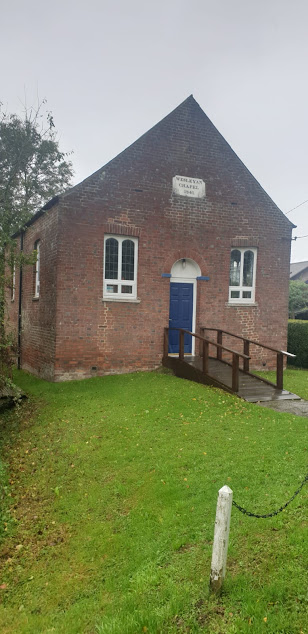
The path heads north across a ploughed field at the start of
the walk near Upstreet.
This is a relatively easy 9 mile walk from Upstreet to Herne Bay over fairly level ground. It passes through mainly arable farmland with a short stretch through orchards at Boyden Gate & a final leg along the coast between Reculver & Herne Bay. The route is easy to navigate as you simply head due north from Upstreet to Reculver & then turn west & follow the coastline to Herne Bay. Way marking is good the whole way. The only area where things can be a little confusing is among the orchards at Boyden Gate but if you just follow the compass north you should have no problem. There are regular bus services between Canterbury & Upstreet at the beginning of the walk & Herne Bay & Canterbury at the end. The weather on the day I did this walk was very murky with persistent heavy rain & this accounts for the poor quality of the photographs. I will definitely do this walk again during better weather, probably next spring.
Shortly after the start of the walk the Sarre Penn stream is
crossed via a small foot bridge.
This is a 13km tributary of the R. Stour which rises in
Dunkirk, north of Canterbury & then
joins the R. Wantsum at Sarre before flowing into the Stour near Plucks Gutter.
The lower reaches near Sarre are known locally as the Fishbourne Stream.
A misty view of Chislet Village in the rain. The SSW passes
just to the east of the village through the hamlet of Chitty.
Area-wise Chislet is one of the largest parishes in north east Kent. It has several notable features including its chunky looking church of St. Mary the Virgin which was built by the Normans during the 12th C. It was also home to the Chislet Colliery coal mine located ~2miles south west of the village at Hersden . This was in operation between 1918 & 1969 & produced a type of coal sought after by the steel industry. At its height it employed some 1550 miners. Interestingly the mining operations led to the creation of the nearby Stodmarsh National Nature Reserve when underground workings caused subsidence over a large area of the R. Stour valley. The subsequent formation of shallow lagoons & what was to become the largest reed-bed in S.E.England created a valuable natural habitat for many rare species of birds, insects & aquatic plants. Stodmarsh was given SSSI status in 1951 & declared a National Nature Reserve in 1968.
The SSW passes the grade ll listed 18thC Invicta Cottage in
the hamlet of Chitty, near Chislet village.
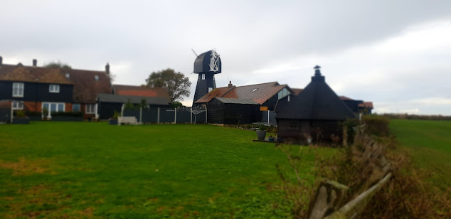
After leaving the apple orchards at Boyden Gate the SSW
follows a quiet lane before crossing a bridge over the busy Thanet Way motorway
to pass close-by Chislet Windmill. A smock mill was built here in 1744 &
remained working until 1916 when it was badly damaged in a gale. During World
War II, Barnes Wallis lived in the mill house & observed the tests of his
famous ‘bouncing bomb’ at Reculver from
the top of the mill. Unfortunately it was destroyed by a fire in 2005 but a
replica mill was built in its place in 2011.
Texel sheep grazing next to the path near Reculver. This is
a popular breed with farmers because of the demand for its high quality very
lean meat.
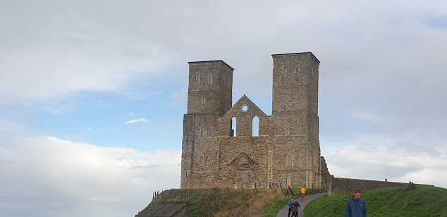
The Towers, Reculver.
Soon after
the Roman invasion of Britain in AD43 a settlement based on a harbour was
established here at the northern end of the 3 mile-wide Wantsum sea channel
which, in those days, separated the Isle of Thanet from the Kentish
mainland. Richborough ( Roman Rutupiae or Portus Ritupis), the principle port
of the new Roman Britannia Province & built on the site where the Romans
first came ashore, was located at the southern end of this channel. The Roman
settlement at Reculver grew in size & during the early 3rd
century one of the earliest Saxon Shore Forts ( Regulbium) was built here to
protect the area against Saxon & Frankish raiders. By the fifth century the
fort had been abandoned & an Anglo Saxon monastery was founded on the site
in 669. The church of St. Mary was built here as part of the monastery complex
and during the tenth century this became the parish church of Reculver after
the monastery ceased to exist. The famous twin towers were added as part of a
remodelling of the church during the twelfth century. Coastal erosion became an
increasing problem during subsequent years & in 1805 the medieval church
was partly demolished & the stone used in the construction of a new church
on higher ground at nearby Hillborough. The twin towers had become an important
landmark & navigational aide for mariners so were left in place &
subsequently bought, repaired & reinforced by Trinity House in 1809.
Looking back along the SSW towards Reculver from Herne Bay.
From Reculver the SSW follows a well defined path along the
coastline to Herne Bay which is situated some 2 miles to the east. Herne Bay (pop. 40,000), a quiet & pleasant town renowned for its sunny climate is
popular with retirees. It developed rapidly as a seaside resort during the
nineteenth & early twentieth centuries after the arrival of the railway during the
1830’s made it easily accessible from London. The town’s mile long parade &
¾ mile long iron pier were great attractions, especially the latter which
allowed paddle steamers carrying visitors
from London & the Medway Towns to dock here. The advent of foreign
holidays during the latter half of the twentieth century has led to a marked
decline but it remains an attractive seaside town to visit. Unfortunately the
pier remains in a poor state of repair after severe damage incurred during
storms & the pier head remains isolated out at sea. There have been several
plans to repair & reinstate the structure but so far nothing has
materialised.


No comments:
Post a Comment