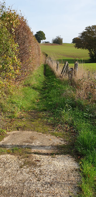
Sheep grazing along the old cliff line near Aldington.
A 6mile walk along the Saxon Shore Way path from Aldington
to Ham Street with a short diversionary trip to the hamlet of Orlestone.
This is quite an easy walk through picturesque
farmland & ancient woodland. Way marking is quite adequate along most of
the route with just a few possible problems in the Aldington/Bonnington area
& the woodlands between Fagg’s Farm, Bilsington & Horton Green,
Ruckinge. Be warned though, that some of the stiles are in a poor state of
repair & many way markers are very old & rapidly disintegrating. Most
of the terrain is level. Public transport to Aldington is limited to a small
private company which operates a bus service from Ashford (Park St.) during the
mornings & early afternoon on weekdays only. There are frequent bus &
train services between Ham Street & Ashford.
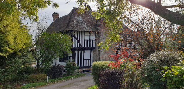
Cherry Orchard Cottage, Bonnington. A lovely old timber
framed cottage, c.1691.
After descending the old cliff line at Aldington the SSW
passes through the hamlet of Bonnington which is centered on Cherry Orchard
Lane. At the end of this lane it heads S. down Rocky Bourne Road for a short
distance before heading off W. through Park Wood.
The chapel at Bilsington Priory.
After exiting Park Wood & crossing a grassy meadow the
SSW turns S. down Priory Road & passes Bilsington Priory on the left.
Founded in 1253, this priory was home to the ‘Black Canons’ of St. Augustine’s
Order until It was suppressed during the Dissolution of the Monasteries in1536.
After this, it fell into decay & was, among other things, used for storing
contraband by the notorious Aldington & Ransley smuggling gangs during the
early 19thC. It was later restored & is now a popular wedding venue.
The path through Priory Wood
Just past the entrance to the priory the path leaves the
road & heads W. through Priory Wood, a beautiful area of ancient woodland
composed chiefly of oak & hornbeam. There were several large parasol
mushrooms growing alongside the path here. This is a non–poisonous species
which is much sought after by gourmets.
Parasol mushroom ( macrolepiota procera) growing alongside
the path through Priory Wood.
On exiting Priory Wood, the SSW crosses a lane near Fagg’s
Farm & passes through an area of large arable fields & woodlands
(Dyne’s Wood & Norland Wood) before joining another lane at Horton Green,
Ruckinge. From this point onwards the SSW follows the same route as the
Greensand Way. After heading S. down the lane for a short distance the path
turns W. & crosses a couple of fields before arriving at Gill Farm.
Looking
back along the path near Gill Farm, Ruckinge.
Medlar tree, Gill Farm
From Gill Farm the SSW/GSW follows Gill Lane W,
& then S.S.W. to enter Ham Street Woods, National Nature Reserve. This
beautiful expanse of ancient woodland is part of Orlestone Forest and is
actually a remnant of the continuous oak forest that once covered the Weald. It
has SSSI status & is home to several rare species of moths &
butterfflies as well as rare breeding birds such as the nightingale &
hawfinch. Whilst passing through the woods we were lucky enough to see a
ringtail harrier fly out of the trees & across a neighbouring field.
Ham
Street Woods, National Nature Reserve.
Another fine parasol mushroom, Ham Street Woods.
As we arrived at Ham Street earlier than expected we made a
short diversionary trip to the nearby hamlet of Orlestone. Ham Street actually
lies within the parish of Orlestone but is now by far the largest centre of
population. Orlestone ‘village’, (if you can call it that), consists of only
the church, a farm & one or 2 old houses. However, it wasn’t always like
that. Before the arrival of the railway during the 1850’s, the settlement at
Ham Street was virtually non-existent. Then it was simply known as ‘Ham’,
‘Street’ being added after the arrival of the railway. From that time onwards
the population grew rapidly here whilst Orlestone remained a quiet hamlet.
The Church of St.
Mary the Virgin, Orlestone was built by the Normans during the late 12thC.
Court Lodge, Orlestone, dates from the 15thC. It is a
beautiful timber framed grade II listed former farmhouse & is now used as a
wedding venue.
The view from near Orlestone Church looking S. over Ham
Street Woods towards Romney Marsh.


No comments:
Post a Comment