Wednesday, 28 October 2020

Saxon Shore Way, Upstreet to Herne Bay (25/10)

The path heads north across a ploughed field at the start of the walk near Upstreet.

The path heads north across a ploughed field at the start of the walk near Upstreet.

This is a relatively easy 9 mile walk from Upstreet to Herne Bay over fairly level ground. It passes  through mainly arable farmland with a short stretch through orchards at Boyden Gate & a final leg along the coast between Reculver & Herne Bay. The route is easy to navigate as you simply head due north from Upstreet to Reculver  & then turn west & follow the coastline to Herne Bay. Way marking is good the whole way. The only area where things can be a little confusing is among the orchards at Boyden Gate but if you just follow the compass north you should have no problem. There are regular bus services between Canterbury & Upstreet at the beginning of the walk & Herne Bay & Canterbury at the end. The weather on the day I did this walk was very murky with persistent heavy rain & this accounts for the poor quality of the photographs. I will definitely do this walk again during better weather, probably next spring.

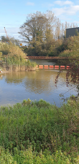
                                          Sarre Penn stream

Shortly after the start of the walk the Sarre Penn stream is crossed via a small foot bridge.

This is a 13km tributary of the R. Stour which rises in Dunkirk, north of Canterbury  & then joins the R. Wantsum at Sarre before flowing into the Stour near Plucks Gutter. The lower reaches near Sarre are known locally as the Fishbourne Stream.

A misty view of Chislet Village in the rain.

A misty view of Chislet Village in the rain. The SSW passes just to the east of the village through the hamlet of Chitty.

Area-wise Chislet is one of the largest parishes in north east Kent. It has several notable features including its chunky looking church of St. Mary the Virgin which was built by the Normans during the 12th C. It was also home to the Chislet Colliery coal mine located ~2miles south west of the village at Hersden . This was in operation between 1918 & 1969 & produced a type of coal sought after by the steel industry. At its height it employed some 1550 miners. Interestingly the mining operations led to the creation of the nearby Stodmarsh National Nature Reserve when underground workings caused subsidence over a large area of the R. Stour valley. The subsequent formation  of shallow lagoons & what was to become the largest reed-bed in S.E.England created a valuable natural habitat for many rare species of birds, insects & aquatic plants. Stodmarsh was given SSSI status in 1951 & declared a National Nature Reserve in 1968.

grade ll listed 18thC Invicta Cottage in the hamlet of Chitty, near Chislet village.

The SSW passes the grade ll listed 18thC Invicta Cottage in the hamlet of Chitty, near Chislet village.


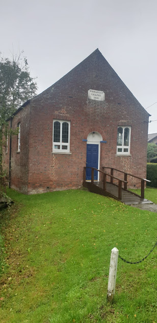
Wesleyan chapel

The path passes close by this Wesleyan chapel (1841) in the hamlet of Boyden Gate & then weaves its way through prolific apple orchards. I think the variety grown here is mainly the New Zealand apple, ‘Jazz’.

Water-logged apple orchards, Boyden Gate.

Water-logged apple orchards, Boyden Gate.


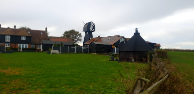
Chislet Windmill.

After leaving the apple orchards at Boyden Gate the SSW follows a quiet lane before crossing a bridge over the busy Thanet Way motorway to pass close-by Chislet Windmill. A smock mill was built here in 1744 & remained working until 1916 when it was badly damaged in a gale. During World War II, Barnes Wallis lived in the mill house & observed the tests of his famous ‘bouncing bomb’ at  Reculver from the top of the mill. Unfortunately it was destroyed by a fire in 2005 but a replica mill was built in its place in 2011.

Texel sheep grazing next to the path near Reculver.

Texel sheep grazing next to the path near Reculver. This is a popular breed with farmers because of the demand for its high quality very lean meat.


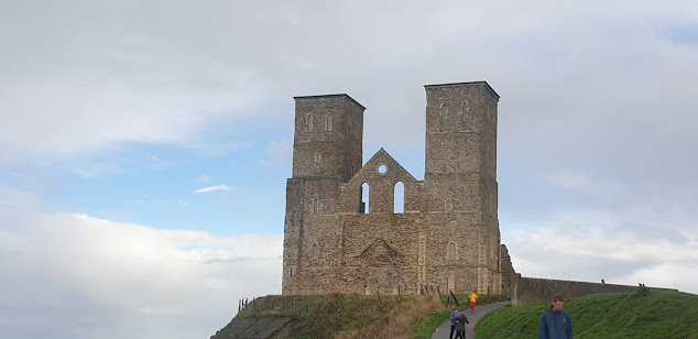
The Towers, Reculver.

The Towers, Reculver.

Soon after the Roman invasion of Britain in AD43 a settlement based on a harbour was established here at the northern end of the 3 mile-wide Wantsum sea channel which, in those days, separated the Isle of Thanet from the Kentish mainland. Richborough ( Roman Rutupiae or Portus Ritupis), the principle port of the new Roman Britannia Province & built on the site where the Romans first came ashore, was located at the southern end of this channel. The Roman settlement at Reculver grew in size & during the early 3rd century one of the earliest Saxon Shore Forts ( Regulbium) was built here to protect the area against Saxon & Frankish raiders. By the fifth century the fort had been abandoned & an Anglo Saxon monastery was founded on the site in 669. The church of St. Mary was built here as part of the monastery complex and during the tenth century this became the parish church of Reculver after the monastery ceased to exist. The famous twin towers were added as part of a remodelling of the church during the twelfth century. Coastal erosion became an increasing problem during subsequent years & in 1805 the medieval church was partly demolished & the stone used in the construction of a new church on higher ground at nearby Hillborough. The twin towers had become an important landmark & navigational aide for mariners so were left in place & subsequently bought, repaired & reinforced by Trinity House in 1809.

Looking back along the SSW towards Reculver from Herne Bay.

Looking back along the SSW towards Reculver from Herne Bay.

From Reculver the SSW follows a well defined path along the coastline to Herne Bay which is situated some 2 miles to the east. Herne Bay (pop. 40,000), a quiet & pleasant town renowned for its sunny climate is popular with retirees. It developed rapidly as a seaside resort during the nineteenth & early twentieth centuries after the arrival of the railway during the 1830’s made it easily accessible from London. The town’s mile long parade & ¾ mile long iron pier were great attractions, especially the latter which allowed paddle steamers carrying visitors  from London & the Medway Towns to dock here. The advent of foreign holidays during the latter half of the twentieth century has led to a marked decline but it remains an attractive seaside town to visit. Unfortunately the pier remains in a poor state of repair after severe damage incurred during storms & the pier head remains isolated out at sea. There have been several plans to repair & reinstate the structure but so far nothing has materialised.


Thursday, 22 October 2020

Saxon Shore Way, Aldington to Ham Street - including Orlestone (19/10)


Sheep grazing along the old cliff line near Aldington.

Sheep grazing along the old cliff line near Aldington.

A 6mile walk along the Saxon Shore Way path from Aldington to Ham Street with a short diversionary trip to the hamlet of Orlestone.

This is quite an easy walk through picturesque farmland & ancient woodland. Way marking is quite adequate along most of the route with just a few possible problems in the Aldington/Bonnington area & the woodlands between Fagg’s Farm, Bilsington & Horton Green, Ruckinge. Be warned though, that some of the stiles are in a poor state of repair & many way markers are very old & rapidly disintegrating. Most of the terrain is level. Public transport to Aldington is limited to a small private company which operates a bus service from Ashford (Park St.) during the mornings & early afternoon on weekdays only. There are frequent bus & train services between Ham Street & Ashford. 

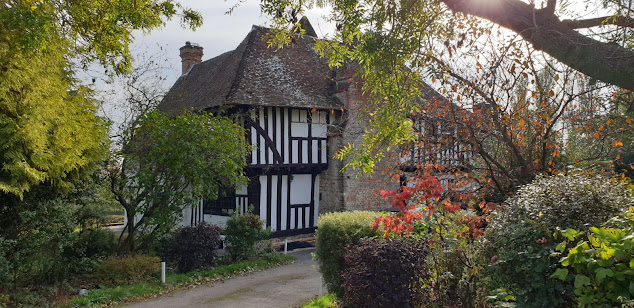
Cherry Orchard Cottage , Bonnington. Beautiful old timber framed cottage cottage, c.1691.

Cherry Orchard Cottage, Bonnington. A lovely old timber framed cottage, c.1691.

After descending the old cliff line at Aldington the SSW passes through the hamlet of Bonnington which is centered on Cherry Orchard Lane. At the end of this lane it heads S. down Rocky Bourne Road for a short distance before heading off W. through Park Wood.

Bilsington Priory.
The chapel at Bilsington Priory.


After exiting Park Wood & crossing a grassy meadow the SSW turns S. down Priory Road & passes Bilsington Priory on the left. Founded in 1253, this priory was home to the ‘Black Canons’ of St. Augustine’s Order until It was suppressed during the Dissolution of the Monasteries in1536. After this, it fell into decay & was, among other things, used for storing contraband by the notorious Aldington & Ransley smuggling gangs during the early 19thC. It was later restored & is now a popular wedding venue.

The path through Priory Wood, Bilsington.
The path through Priory Wood

Just past the entrance to the priory the path leaves the road & heads W. through Priory Wood, a beautiful area of ancient woodland composed chiefly of oak & hornbeam. There were several large parasol mushrooms growing alongside the path here. This is a non–poisonous species which is much sought after by gourmets.

Parasol mushroom ( macrolepiota procera) growing alongside the path through Priory Wood.

Parasol mushroom ( macrolepiota procera) growing alongside the path through Priory Wood.

On exiting Priory Wood, the SSW crosses a lane near Fagg’s Farm & passes through an area of large arable fields & woodlands (Dyne’s Wood & Norland Wood) before joining another lane at Horton Green, Ruckinge. From this point onwards the SSW follows the same route as the Greensand Way. After heading S. down the lane for a short distance the path turns W. & crosses a couple of fields before arriving at Gill Farm.

Looking back along the path near Gill Farm.

Looking back along the path near Gill Farm, Ruckinge.

Medlar tree, Gill Farm.

Medlar tree, Gill Farm

From Gill Farm the SSW/GSW follows Gill Lane W, & then S.S.W. to enter Ham Street Woods, National Nature Reserve. This beautiful expanse of ancient woodland is part of Orlestone Forest and is actually a remnant of the continuous oak forest that once covered the Weald. It has SSSI status & is home to several rare species of moths & butterfflies as well as rare breeding birds such as the nightingale & hawfinch. Whilst passing through the woods we were lucky enough to see a ringtail harrier fly out of the trees & across a neighbouring field.

Ham Street Woods, National Nature Reserve.

Ham Street Woods, National Nature Reserve.

Another fine parasol mushroom, Ham Street Woods.

Another fine parasol mushroom, Ham Street Woods.

As we arrived at Ham Street earlier than expected we made a short diversionary trip to the nearby hamlet of Orlestone. Ham Street actually lies within the parish of Orlestone but is now by far the largest centre of population. Orlestone ‘village’, (if you can call it that), consists of only the church, a farm & one or 2 old houses. However, it wasn’t always like that. Before the arrival of the railway during the 1850’s, the settlement at Ham Street was virtually non-existent. Then it was simply known as ‘Ham’, ‘Street’ being added after the arrival of the railway. From that time onwards the population grew rapidly here whilst Orlestone remained a quiet hamlet.

St. Mary's church, Orlestone.

 The Church of St. Mary the Virgin, Orlestone was built by the Normans during the late 12thC.

Court Lodge, Orlestone.

Court Lodge, Orlestone, dates from the 15thC. It is a beautiful timber framed grade II listed former farmhouse & is now used as a wedding venue.

The view looking over Ham Street Woods towards Romney Marsh.

The view from near Orlestone Church looking S. over Ham Street Woods towards Romney Marsh.

Thursday, 15 October 2020

Saxon Shore Way, Grove Ferry (Upstreet) to Sandwich (10/10)


This is a 10 mile walk following the Saxon Shore Way along the Little & Great Stour Rivers. Access to the Saxon Shore way path at Grove Ferry is easily possible by a frequent bus service from Canterbury. Most of the route is easy to navigate as it runs next to either the Little or Great Stour rivers virtually the whole way to Sandwich. The only place where I encountered problems was at the start of the walk. Here the path initially runs along the south bank of the Great Stour through the popular Grove Ferry picnic site & then, after a short distance, it migrates south across fields to the Little Stour. I found the way markers in this area rather misleading. However, once you reach the Little Stour you cross a small footbridge to the south bank & simply follow the river east for ~1.5mls to Plucks Gutter where it joins the Great Stour. The path then follows the Great Stour, east, right to the outskirts of Sandwich. There is a frequent bus service from there back to Canterbury.

Grove Ferry

The Great Stour at Grove Ferry is popular for boating & canoeing. It is also adjacent to the Stodmarsh National Nature Reserve.

Little Stour

The Little Stour is the main tributary of the Great Stour. It originates at springs near Well Chapel, Bekesbourne & flows into the Great Stour at Plucks Gutter.

Landscape to S. Of Stour

The landscape to the south of the route is rather flat, featureless & uninspiring.

Great Stour.

The Great Stour looking east towards Richborough.

Sheep grazing by Great Stour.

Sheep grazing by the Great Stour.

Sussex cattle.

Sussex cattle with their calves in a field a little further along the river. This popular breed of beef cattle is descended from the draught oxen long used traditionally in the Weald of Kent & Sussex. They are easy to handle & renowned for their hardiness & ability to thrive on the poorest of pastures. 

Wind turbine near Richborough.

Wind turbine near Richborough.

Stoner Cut.

The Stonar Cut, near Richborough, is a channel constructed across the neck of a large loop in the Great Stour & controlled by flood gates. It was built during the late 18thC. to protect Sandwich & the surrounding farmland from flooding. If the flow in the river is running full after heavy rainfall the Stonar Cut gates are opened to divert part of the flow directly into the estuary below Sandwich, thus bypassing the town. The Cut is also useful in obviating the need for seagoing vessels to take the longer route around the loop at Sandwich.

Richborough Castle.

Richborough Castle lies to the west of the Saxon Shore Way just to the north of Sandwich & is accessible by a footpath across a railway line adjacent the route. It occupies the site of the first Roman landing during their invasion of Britain in AD43 and the prosperous town which developed here became the principle port for the new Britannia province. It also served as a base for the British arm of Roman navy, the Classis Britannica. As the coastline silted up the town gradually declined and was gradually abandoned. In AD 275 the original fort was demolished and replaced by a new one which was to become the most important of the Saxon Shore forts built by the Romans to protect the Kent coast from Saxon & Frankish raiders. Richborough Castle constitutes the ruins of this fort. These ruins & a small museum are open to the public.

Richborough Castle.

The Butts, Sandwich.

Just south of Richborough Castle the Saxon Shore Way leaves the banks of the Stour & passes beneath a road bridge carrying the busy A256, Ramsgate Road. It then goes down a quiet road to the outskirts of Sandwich where you follow the attractive Butts footpath into the centre of town. This path actually follows the site line of the now non- existent western medieval defensive town wall of Sandwich.

There is a regular bus service back to Canterbury which leaves from the Sandwich Guildhall.

Monday, 12 October 2020

Lucky glimpse of a humming bird hawk-moth (11/10)


This morning we had a hummingbird hawk-moth visit our garden. It was hovering around the blue flowers of a hardy plumbago plant. I have seen them in previous years but never so late as this & they’re normally attracted to the flowers of either buddleia or red valerian. The flowers of the latter are virtually finished now & the hardy plumbago is one of the few plants still produclng reasonably nectar-rich flowers this late in the season.

Hummingbird hawkmoths chiefly inhabit the Mediterranean area but each spring a number of them migrate northwards to the UK. They normally arrive from early June onwards & some remain to breed. They lay their eggs on either bedstraws or wild madder but occasionally, have been known to lay them on red valerian, The cycle from egg to adult moth is around 8 weeks. In late summer the majority of the adults return to the Mediterranean but a few individuals attempt to overwinter here. The majority will not survive the cold but in recent years with climate change leading to milder winters an increasing number of these attractive moths are making it through to re-emerge in the spring. I hope our visitor will be one of them.


Sunday, 4 October 2020

Saxon Shore Way - Aldington to Sandling (28/09)

This 8-mile section of the SSW is very scenic with beautiful panoramic views over Romney Marsh & the English Channel. It is a relatively easy walk with only one hilly section where the path leads up the scarp face of the old cliff line from the Royal Military Canal to Lympne Place. There are 3 short sections along main roads which are not particularly pleasant because the verges are narrow & traffic is quite frequent. Way marking is good apart from the section between Oathill Barn, Lympne & Pedlinge.

The parish church of St. Martin, Aldington

Aldington is a small village located on the summit of the old cliff line approximately 5 miles S.E. of Ashford. The parish church of St. Martin is 3/4-mile E. of the village and dates from the 13thC. It is notable for its particularly beautiful 16thC. W. tower & the fine views it offers over Romney Marsh. The village has had a remarkable number of famous residents including Erasmus, the theologian; Elizabeth Barton, the 16thC. 'Mad Maid of Kent; Joseph Conrad, the novelist; and Noel Coward, the playwright, actor & composer.

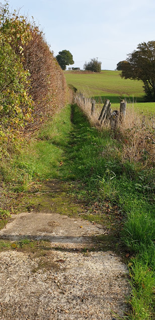
The SSW heads S. from Aldington through pleasant countryside

The SSW heads S. from Aldington through pleasant countryside past Honeypot Farm to Honeypot Cottage where it turns E. along a path beside the Royal Military Canal.

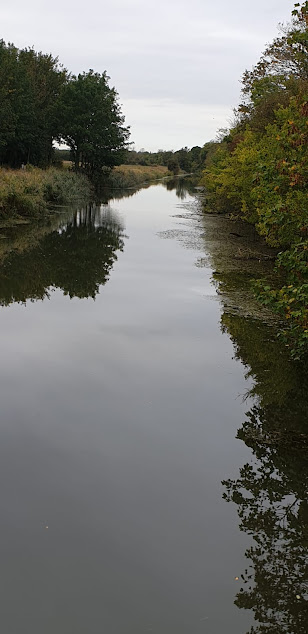
Path beside the Royal Military Canal

The path beside the canal is enclosed by trees & bushes which obscure views of both the canal & the surrounding countryside.

Aldergate Bridge

After~1 mile you pass Aldergate Bridge where decent views can be had along the canal.

Port Lympne Reserve - giraffes

A short distance further on, the SSW leaves the canal & heads N. up the old cliff line & through Port Lympne Reserve. This is a renowned breeding sanctuary for rare & endangered animals & covers over 600 acres. You can catch glimpses of the animals from the path. (Please note : there is no apparent way marker by the  Royal Military Canal).

Views to the south over Romney Marsh & Dymchurch Redoubt

At the top of the hill, where you meet a road, the route turns S.E. along a wooded path to Coombe Farm. After passing the farm extensive views open up to the south over Romney Marsh & Dymchurch Redoubt where Canal Cutting snakes its way towards the sea.

Lympne Castle

The path shortly arrives at beautiful Lympne Castle which is perched on the edge of a cliff overlooking Romney Marsh & occupies the former site of a Roman watch tower. The first castle was built here in 1080 for the Archdeacon of Canterbury & then rebuilt in the 14thC. Below the castle at the foot of the cliff are the ruins of Stutfall Castle, a Roman shore Fort, 'Lemanis Fort', which was built at the end of the 3rdC. to protect the adjacent harbour of Portus Lemanis & its resident fleet, the Classii Britannica. It formed part of the chain of coastal fortifications built by the Romans to repel the increasing number of attacks by Saxon raiders around the coast of S.E. Britain.

Cyclamen

Cyclamen growing on the edge of the drive leading into Lympne Castle.

Shepway Cross - Cinque Ports War Memorial on Lympne Hill

The  SSW follows the driveway from the castle past the church of St. Stephen to join the main road near Lympne village. It turns to the right here & heads E. along the road & past the Cinque Ports War Memorial on Lympne Hill. Popularly known as the 'Shepway Cross', this is a war memorial unveiled in 1923 to commemorate the men of the Cinque Ports who fought in WWI (& all British conflicts). It occupies the site where the ancient 'King's High Court of Shepway' (founded 1150) used to meet to handle any disputes between the Cinque Ports which the individual boroughs could not deal with themselves. It was presided over by the Lord Warden of the Cinque Ports & had powers equivalent to those of the shire courts.

‘Pedlinge District Chapel-of-Ease in the parish of Saltwood

After ~ 1/2 mile & just past Oathill Barn the route leaves the road & heads N.E. across fields to the hamlet of Pedlinge on the busy Hythe Road (A261). It crosses the road & goes up a path opposite to reach an old chapel. This is officially known as ‘Pedlinge District Chapel-of-Ease in the parish of Saltwood' & was built over 200 years ago by the Hardy family to provide a place of worship for the workers on their neighbouring Sandling Estate.

Chesterfield Wood

From the chapel, the route heads N.E. across a field & through Chesterfield Wood. It exits the wood just after crossing a small footbridge & turns E. After 1/3rd mile you will reach the main road at Sandling & the end of the today’s walk.