This 8-mile section of the SSW is very scenic with beautiful panoramic views over Romney Marsh & the English Channel. It is a relatively easy walk with only one hilly section where the path leads up the scarp face of the old cliff line from the Royal Military Canal to Lympne Place. There are 3 short sections along main roads which are not particularly pleasant because the verges are narrow & traffic is quite frequent. Way marking is good apart from the section between Oathill Barn, Lympne & Pedlinge.
Aldington is a small village located on the summit of the old cliff line approximately 5 miles S.E. of Ashford. The parish church of St. Martin is 3/4-mile E. of the village and dates from the 13thC. It is notable for its particularly beautiful 16thC. W. tower & the fine views it offers over Romney Marsh. The village has had a remarkable number of famous residents including Erasmus, the theologian; Elizabeth Barton, the 16thC. 'Mad Maid of Kent; Joseph Conrad, the novelist; and Noel Coward, the playwright, actor & composer.
The SSW heads S. from Aldington through pleasant countryside past Honeypot Farm to Honeypot Cottage where it turns E. along a path beside the Royal Military Canal.
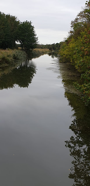
The path beside the canal is enclosed by trees & bushes which obscure views of both the canal & the surrounding countryside.
After~1 mile you pass Aldergate Bridge where decent views can be had along the canal.
A short distance further on, the SSW leaves the canal & heads N. up the old cliff line & through Port Lympne Reserve. This is a renowned breeding sanctuary for rare & endangered animals & covers over 600 acres. You can catch glimpses of the animals from the path. (Please note : there is no apparent way marker by the Royal Military Canal).
At the top of the hill, where you meet a road, the route turns S.E. along a wooded path to Coombe Farm. After passing the farm extensive views open up to the south over Romney Marsh & Dymchurch Redoubt where Canal Cutting snakes its way towards the sea.
The path shortly arrives at beautiful Lympne Castle which is perched on the edge of a cliff overlooking Romney Marsh & occupies the former site of a Roman watch tower. The first castle was built here in 1080 for the Archdeacon of Canterbury & then rebuilt in the 14thC. Below the castle at the foot of the cliff are the ruins of Stutfall Castle, a Roman shore Fort, 'Lemanis Fort', which was built at the end of the 3rdC. to protect the adjacent harbour of Portus Lemanis & its resident fleet, the Classii Britannica. It formed part of the chain of coastal fortifications built by the Romans to repel the increasing number of attacks by Saxon raiders around the coast of S.E. Britain.
Cyclamen growing on the edge of the drive leading into Lympne Castle.
The SSW follows the driveway from the castle past the church of St. Stephen to join the main road near Lympne village. It turns to the right here & heads E. along the road & past the Cinque Ports War Memorial on Lympne Hill. Popularly known as the 'Shepway Cross', this is a war memorial unveiled in 1923 to commemorate the men of the Cinque Ports who fought in WWI (& all British conflicts). It occupies the site where the ancient 'King's High Court of Shepway' (founded 1150) used to meet to handle any disputes between the Cinque Ports which the individual boroughs could not deal with themselves. It was presided over by the Lord Warden of the Cinque Ports & had powers equivalent to those of the shire courts.
After ~ 1/2 mile & just past Oathill Barn the route leaves the road & heads N.E. across fields to the hamlet of Pedlinge on the busy Hythe Road (A261). It crosses the road & goes up a path opposite to reach an old chapel. This is officially known as ‘Pedlinge District Chapel-of-Ease in the parish of Saltwood' & was built over 200 years ago by the Hardy family to provide a place of worship for the workers on their neighbouring Sandling Estate.
From the chapel, the route heads N.E. across a field & through Chesterfield Wood. It exits the wood just after crossing a small footbridge & turns E. After 1/3rd mile you will reach the main road at Sandling & the end of the today’s walk.


No comments:
Post a Comment